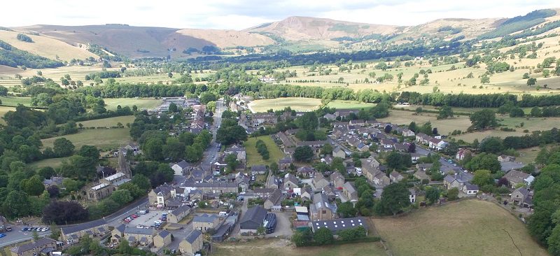

Articles written for the Parish Magazine
by Ann Price
Source material:- Census 1851, Tythe Plan of 1854, Personal communications from Members of HHS and other village persons, photographic records from the Archive.
Contents List
- 1. Introduction
- 2. The Market Place
- 3. School Lane
- 4. Pump Street
- 5. Hope Marsh Smithy
- 6. The Three Horseshoes
- 7. The Middleton Farmhouse
- 8. The Durham Ox
- 9. The OId Hall
- 10. Main Street
- 11. Nos. 1 – 4 Edale Road
- 12. Edale Road – Tythe Barn
- 13. Changes in Edale Road
- 14. Edale Road – The Fold
- 15. Edale Road – Chapel Walk
- 16. Bolsover and Kenmuir Cottages
- 17. Ebenezer House and beyond
- 18. Edale Road around Hope Mill
- 19. Killhill Farm and beyond
- 20. Around the Cheshire Cheese
- 21. Continuing up Edale Road
- 22. Edale Road – Townhead
- 23. Hope Townhead
- 24. More on Townhead
- 25. Farms around the Parish
- 26. Crookstone to Edale End
- 27. Harrop Farm to Birchfield
- 28. Farfield to Laneside
- 29. Brough to Loosehill
- 30. Farming in Hope
- 31. More about Farming
- 32. Hope Village
- 33. Summing up (part 1)
- 34. Summing up (part 2)
1. Introduction
The year is 1851 and a census has just been taken throughout the country. Four years earlier the Tythe commissioners produced a map of our village with details of land ownership, tenancy and acreages. These two documents give us a unique window into life in Hope at this time.So come with me over the next few months and meet the residents of Hope in the 1850s, hear about their jobs and families and discover what life was like in our village then.We start at Netherhall Bridge, looking up the lane towards the church and Market Place. The bridge would have been much narrower than at present. The road, part of the Turnpike since 1760, would have been rutted and dusty in summer, even more rutted and very muddy in winter with the passage of carts and coaches over its surface. It was the job of each parish to fill in the inevitable potholes and local people resented the time taken for this. They petitioned the local magistrates to allow them to discontinue this practice.
The first farm on the right (now Smithy Cottage) was the home of Michael (or Micah) Holmes. He was a wheelwright and held the tenancy of the farmhouse and ten acres of land from the Earl of Newburgh, part of the Hassop estate. He was helped on the farm by his son-in-law Isaac Robinson. Also in the household were his daughter, Hannah and his granddaughter Ann and her baby girl. Ann was not the only unmarried mother in the village as we shall see.
Next door Micah’s son John and his wife Jane were bringing up a young family of four, the older two being of school age. John was a blacksmith and had two apprentices who were living with the family. The younger, James Johnson, was only 13 years old. Like many people in the village John also farmed, renting 9 acres from the Earl of Newburgh. These smallholdings would be vital to the household economy, where hens and poultry could be kept, cows or sheep grazed and some meadows used for hay to feed the animals in the winter. The smithy where Micah and John worked was on the corner near the Old Hall and was an important place in the village when horses and carts were the only means of transport.
Sources; 1847 Tythe Allotment. 1851 Census Returns. Hope Archive information
2. The Market Place.
Hope first held a market in 1715 when John Balguy of Hope Hall procured a licence for a weekly market and four fairs. However, it seems to have had fluctuating fortunes and was “long discontinued” only being revived in 1843. In 1855 it became a monthly cattle market and each year on May 13th a hiring fair was held when those seeking employment would stand in the marketplace with the sign of their trade.
The Market Place would have looked rather different in those days. There would have been open fields to the north with views of Win Hill. There were houses standing at the edge of the current churchyard and down what is now School Lane. These later disappeared as the churchyard was enlarged, but their remains can be seen in the church car park.

The first house on the left, Daggers House, was the home of the Greaves family. One of the oldest houses in the village it was at one time the “Old Stone Daggers Inn”. Its heyday as an inn occurred when the new turnpike road brought coaches and carts through the village between Sheffield and Manchester but by the 1840s it had ceased to be an inn and was owned by the Greaves family.
In 1851 it was lived in by William Greaves, described as a “landed proprietor”. He was an elderly widower with an unmarried son and daughter living with him and a granddaughter of school age. The son’s trade was that of a druggist but whether he worked locally is not recorded. William and his daughter owned five fields between them in Hope which would hardly justify them calling themselves landed proprietors, but maybe they held land elsewhere.
Robert Unwin and his wife Mary and their young family of four lived next door. Their house is also old with a vaulted cellar, a cool place to hang up bacon and other food for the grocer’s shop they ran. Many of the old buildings in the centre of the village had similar cellars. There was a barn attached to the property, still distinguishable as part of Loxley Hall. Robert was also a corn dealer and farmer. He ran a carrier service to and from Sheffield on Tuesdays and Saturdays. All these different occupations would help him to provide for his family.
Sources; 1847 Tythe Allotment. 1851 Census Returns. Hope Archive information
3. School Lane
School Lane is part of an old route way. From ancient times the road had crossed the Peakshole Water by ford and later bridge and followed the lane to the Market Place and so over to Aston and Derwent.
In 1851 there were several houses fronting onto the lane, the remains of some of which are visible in the church car park today. Thomas Deville owned one of the houses and had an annuity. Other occupants were Joseph Hallam, an agricultural labourer, Elizabeth Marsh, described as a pauper and charwoman and Elizabeth Siddall who farmed 11 acres. We think that at one time one of these buildings would have been the schoolmaster’s house as the original founding of the school allows for a house and garden for the schoolmaster.
The school was built in 1658 when Thomas Bocking was vicar and would have contained within its walls the remains of Hope’s Saxon Cross. It was a “Free” school, administered by the church and providing some free education in reading and writing. The teacher was Robert Eardley. The church wardens’ accounts at various times show the following items.
“Pd to John Slack and William Nowell for mossing and pointing ye Schoolhouse 12 daies – 16 shillings”
“Paid William Ibbotson for fire range, Oven and boiler to continue in the Schoolhouse – £2.12s.6d.
Paid Joseph Hill and Micah Holme for stone leading and walling school garden wall – £1.9s.
Thomas Siddall for the use of his house while the schoolhouse was repaired – £1.1s.
Moss appears as a building material for the school in several instances. Was it used on the roof or to plug gaps in the walls I wonder?
By 1851 the schoolhouse was almost two hundred years old and would have been showing signs of dilapidation. It was replaced on the same site in 1858 by the present “Old School”.
By Watergates Bridge, hidden by the encroaching ivy, is the remains of a sheep wash. The sheep would be gathered and perhaps held in the field by the bridge before being driven down the narrow passageway into the river and out via a similar route on the opposite side. This exit disappeared at the time the bridge level was raised. Stray sheep would have been put in the Pinfold nearby until their owners could be traced.
Source: Notes from a Peakland Parish by William Smith Porter
4. Pump Street
When you turned right out of School Lane by Watergates Bridge you would have entered Pump Street (now Pindale Road). A pump was situated on the left where the telegraph pole stands today. The villagers would have collected their water from this and other pumps around the village as there was no mains water supply.
The vicarage and the Manor House both belonged to the vicar, the Rev Cave Brown Cave. At the time of the census in 1851 the old vicarage building was still in use. It is described by Dr Orton, the previous incumbent as
“an old but (now) comfortable parsonage, having been made so at between two and three hundred pounds expense, by the present incumbent, at his sole expense. It contains two parlours, a study and three lodging rooms, exclusive of one for the servants, kitchen, back kitchen, pantry and cellar, but no outbuildings except coach house.”
The Rev Cave Brown Cave borrowed £600 from the governors of the Queen Anne’s Bounty to build a new vicarage but when Rev. John Daniel took possession in 1856 he describes it thus:-
“It was simply a carcase, the floorboards, sashes and doors were on the premises but not fixed, no plastering on any of the walls and ceilings or any painting and papering.”
He also had to put it right at his own expense and the parish had to pay the interest on the building loan.
Whilst re-building the vicarage the family would have lived in the Manor House, which had also had a makeover. It seems to have been empty at the time of the census in 1851 and is described as “The Doctor’s House” – presumably after Dr Orton, the previous vicar with whom Rev Cave Brown Cave exchanged parishes in 1843.
On the corner was the home of the Woodroffe’s. Members had served as church wardens for several generations and they looked after the Parish Registers. As they ran a pub the first register became a little battered, with beer stains and Woodroffe signatures practised in odd corners. The current landlord was Nathan Woodroffe aged 77 who describes himself as a farmer of 60 acres. He was helped by his son-in-law Stephen Shirt. The household also contained his daughter, Martha, grandson William who helped on the farm and two granddaughters, Mary, who was a barmaid, and Jane and also a new great grandson, James.
Sources; – St Peter’s Church Terriers 1840 & 1870. 1851 Census Returns
5. Hope Marsh Smithy
Local residents may remember Cyril Wainwright’s smithy on Castleton Road which stood just beyond the gates of the telephone exchange. It was demolished in the 1960’s as part of a road widening scheme, but it was thought to be one of the oldest buildings in the village.

In 1851 it would have been the last building before the road crossed the Hope marshes to Castleton. It wasn’t a smithy then but was described as a weaving shed and John Robinson, a weaver of Edale Road, may have worked there. It is thought that the cloth would have been sacking for agricultural purposes.
Earlier title deeds described it as a workshop known as the Village School in Marsh Lane. This was possibly the building in which Francis Langton taught in 1559 before the erection of a new school in School Lane. Another use ascribed to it was as a toll bar cottage on the toll road to Castleton. Unfortunately, there are no records to prove the accuracy of these assertions, just folk memory which often contains more than a grain of truth.
It became a smithy sometime around 1870 when Joseph Wainwright moved there from Castleton. His son George and grandson Cyril later carried on the business.Gordon Randles remembers hurrying from school to help Cyril Wainwright blow the bellows to ensure the metal ring for a new wheel was glowing white hot and then dousing the wheel with water to shrink the iron tyre into place. Horses were shod there, and it was an exciting place for local schoolchildren to congregate. The smithy harks back to an age when horses and carts were of primary importance in an agricultural community and the wainwright or cartwright was an essential part of the village.
Photos from Jane Bramwell’s collection, HHS photo archive.
6. The Three Horseshoes
Continuity in the use of a site is always interesting. Where Stuart Reid’s garage now stands, in 1851 Thomas Rowland and his two eldest sons, George and Ellis traded as blacksmiths, keeping the transport of their day in good repair. Thomas was also a farmer with 25 acres and he was helped to work this by his brother, Ralph. Their land consisted of the croft which ran alongside Castleton Road as far as the stream under the road, three fields off Aston Lane rented from Jacob Darwent, Hall Head off Castleton Road rented from the church wardens and the wonderfully named “Peas Bongs” (which roughly means a river embankment) rented from Millicent Greaves. This field can be accessed off Eccles Lane by the stile leading to Brough and is the large field down by the river. These fields were all scattered which must have made farming difficult, and rent would have to be found for all but the croft.
The Rowlands were a large family and like many other people of the time had a side line to help the family finances. This was a beer house, run by Thomas’s two eldest daughters,

Ann and Hannah and was known for many years as “The Three Horseshoes”, with an appropriate sign above the door no doubt made in the smithy. It was later called “The Blacksmith’s Arms”. There were also two school age children at home, Sarah Ann and John.
The other two cottages which form part of the terrace belonged to Thomas and were rented out. The middle one was the home of the Pollard family. Elizabeth, the head of the family was 64. She was a charwoman and her son William was a farm labourer. Also living with her were her daughter, Grace Pollard, who was a dressmaker and Grace’s three children, Elizabeth, Ann andWilliam, all of whom were at school. The children were all born in Manchester, so apparently Grace, who was unmarried, had brought her children back home to mother.
The third cottage in the group was lived in by 74 year old Margaret Ashton, who ran a small shop.
The photograph is dated later than 1850 but shows the group of buildings much as they would have appeared then.
Sources: 1847 Tythe Allotment, 1851 Census. Photo from Hope Historical Archive courtesy of Jane Bramwell
7. The Middleton farmhouse
In 1851 Middleton’s farmhouse stood squarely in its farmyard opposite the end of Pindale Road. The family were one of the larger landholders in the village, farming 175 acres. In 1850 Robert Middleton had inherited the land and property after the death of his father William two years earlier.
He lived in the house with his wife Elizabeth and their children. John, aged 13, was at home, but Mary, Elizabeth and Alfred were all at school. We know the farmhouse today as “Spar” grocers. The Indian restaurant and Valley Ramblers were all farm buildings around the farmyard. There was a barn down Pindale Road and the family owned or rented property in Edale Road.

The farmhouse was one of the older buildings in the village. It had a cellar, now filled in, and people may remember the old oak beams and the hooks for hanging meat and other goods, now hidden by later renovations
The photograph shows the farm as it would have looked in the late 1800s. The property that now houses “Hope Deli”, “Eighteen Bikes” and the café was not built until after 1906 when the Middleton family sold up. At that time the farmhouse was bought by A.F. Hancock, the grocer and David Bramwell from Tideswell bought the farmyard and buildings and built a house and shop in the space.
Opposite the farmhouse was a set of lock up shops on the edge of the churchyard known as “the Shambles.” One of them was a butcher’s shop run by Joseph Watson, the “Shambles” being the traditional name for an area where butchers operated. John Proctor ran his saddlery business from another of the shops. Sarah Bolsover was a dressmaker, and the other resident was Abraham Bolsover who was described as a former agricultural labourer and now a pauper. Behind the shops ran a footpath to a stile in the corner opposite the Woodroffe Arms.
The buildings built around the churchyard have long gone, demolished to make more room in the graveyard. The Shambles do not appear on the 1880 OS map although the footpath is still shown. Other houses round the graveyard on School Lane are marked on the 1898 OS map but not after that.
Sources: 1851 Census Returns
Photograph from Edwin Chapman Collection, Hope Historical Society Archive
8. The Durham Ox
Next to William Middleton’s farmhouse is another of the older buildings in the village. In 1850 it was a beer house known as the Durham Ox. The farmhouse would originally have had a similar roof line but at some stage the Middletons built a new larger front to their property and raised the roof to its current level.
William Middleton leased the Durham Ox from George Nuttall and sub-let it to the Hobson family. Doreen Sedgewick (nee Hobson) has put together a booklet for the Historical Society detailing her family’s life at the inn. In 1850, as well as running the beer house, John Hobson was a farmer of 16 acres using the barns and yard behind the inn and leasing fields within the parish. There is a record of the ale accounts for 1842 giving details of how much individuals spent. Ale probably cost about 3d a pint and was important at a time when there was no piped water supply. It seems that the Hobson bought in their ale from G Crookes of Sheffield. Doreen was told that in the 1890s the beer used to be lined up on the bar in readiness for the gangs at work on the railway. Another family story was that children attending Hope school from Derwent and Hope Woodlands stayed at the Durham Ox during the week.
Like so many other families of the time the Hobsons had more than one occupation in order to make ends meet. They were also cordwainers (shoemakers) and in 1850, when John Hobson died, his son William carried on the business. Doreen also has the shoemaking account book. The Hobsons made cloth boots for John Wilson’s wife for 9s/9d, new boots for Mrs Hadfield at 10/- and put a cap on Thomas Darwent’s boots for 3d.

The most expensive item was a leather bucket (waterkine) which cost Thomas Wain and Charles Bramwell 16/- . Elizabeth Hobson was also involved in shoe binding and used the account book in 1853 to record the sales which cost 1/-. It seems to have been a popular service.
Later the building was used for many years as a Post Office and as a bank.
Source – from the original booklet by Doreen Sedgewick.
9. The Old Hall.
The largest building in the centre of the village after the church was The Hall Hotel, owned by Rev.Nathaniel Hubersty, but later to become part of Trusswell Breweries of Sheffield.
The Old Hall had been an inn for some considerable time. Originally it was the home of the Balguy family, who also built Aston Hall. The Balguys were an old established Hope family but according to the Lyson brothers who recorded much of Derbyshire’s history, “by 1817 it was the property of John Dakin and occupied as an inn.” It was John Dakin who rebuilt the front of the building, but the rear part is older, and may be of 16thC construction.
Writing for a series in the Derbyshire Times in 1922 Seth Evans describes what remains of this earlier hall. One wing of the property had been converted into cottages with entrances changed to face the Edale Road. There seems to have been a walled garden, with large stone gateposts at the entrance, the remains of which can still be seen today. The old smithy on the corner (now demolished) was once the lodge to the hall. Recently a well has been discovered which would have provided earlier residents with their water supply.
In 1851 the landlord was George Bocking, described in the census as “Innkeeper and Coach Proprietor.” Those living with him at the Old Hall were Charlotte his wife, his two daughters Elizabeth and Maryanne aged twelve and ten and his father-in-law, Joseph Hobson aged 73, an assistant innkeeper. There were also three servants, Bridget Kelly, a house servant and two farm workers, Samuel Redfern and Thomas Boot. These last two would have helped with the horses for the coaches and worked on the land that George farmed.

This land seems to have been part of Croft Head Farm, rented from the Earl of Newburgh. There is no census record of anyone living in the farm at this time, so maybe this is where the coach horses were stabled.
The Old Hall has had a long history of community involvement. When the Oddfellows were established in 1845 their constitution set out that they should meet “at the house of Brother George Bocking”
The photograph shows the Old Hall in the 1890s
10. Main Street – Edale Road
Our tour of Hope turns the corner into what is now Edale Road, but in 1850 was known as Main Street. Standing on the corner today it is interesting to see the changes that have occurred in 170 years. Buildings have been demolished or altered and new ones have appeared. Even so the original character of the street remains much as it was in those far off days. Many of the houses (tofts) are built side on to the road with land (or croft) running away in a long ribbon beyond. To have a piece of land on which you could keep hens and a pig and grow your own vegetables and herbs was important in helping to keep your family fed. None of the houses are imposing. They were built of the local stone, (perhaps brought down from the parish quarry at Crookstone), usually on a plinth but with no damp proof course.

The windows were also small so they did not let in too much cold in winter and kept the house cool in summer. At some stage many of the houses were covered with grey pebble-dash.
It has been difficult to find out who lived in which house on Main Street from the 1851 census because the enumerator did not give a house number to the properties. However the 1847 Tythe map gives a list of owners and tenants and that has helped to fix many addresses. We start with the three houses that were originally a wing of Hope Hall. They stood where Café Adventure now stands. Many Hope residents will remember Mrs Mills’s grocers and Mrs Thorpe’s draper’s shops before they were demolished in 1958. The first house is still there as Old Hall Cottage and the Church shop is where Mr Watson had his butcher’s shop. We think that Old Hall Cottage was a dame school run by Mary and Hannah Bennet. Seth Evans in his “History of Hope” in the Derbyshire Times of 1922 certainly places them there. One of the other two houses was run as a lodging house by Elizabeth Robertson helped by a fifteen year old servant, Ann Bolsover. There were two lodgers, Betty and Ann Dakin aged 24 and 21 who describe themselves as “Landed Proprietors”. Also living there was Elizabeth’s sixty three year old brother who was a weaver. We think the third house was empty at this time
11. Nos.1 – 4 Edale Road
Much of what we have learned about local houses stems from a Historical Society project in which members researched the history of their own homes. I am indebted to Christine Davies for the information about the houses that are now 1- 4 Edale Road.
The whole of the terrace on this side of the road is confusing in its make-up. The house on the corner seems to have varied from being part of the Durham Ox on Castleton Road and part of the terrace on Main Street.

This photograph of the row of houses at the start of Main Street shows that at one time there was a doorway with a sign above it leading into the Durham Ox.
The next door gives on to a passage leading to the back of the properties and there are four houses in the rest of the terrace. If you look closely at the stonework today you can still find evidence of doors and windows that have been altered. In 1851 the Durham Ox and the houses were owned by George Nuttall and there were four homes. Number 1 had been lived in by William Watson who had died recently and this was empty.
George Rowland and his family lived in the second of the houses in the terrace. He was a blacksmith, brother of Thomas Rowland who owned the smithy on Castleton Road. His wife, Mary and three children, Mary (16), Charles (7), at school and Elizabeth (3) lived with him and also his mother-in-law, Martha Harrison who is described as a pauper, late a farmer, born in Aston.
Robert Shirt and family lived in the third house in the row. Robert was an agricultural labourer and he and his wife Rachel had five sons. The eldest two, Isaac (16) and George (12) were “at home” as were the youngest Henry (6) and Joseph (3). Only Robert (10) was at school.
William Thorpe lived in the last of the houses at the time of the Tythe apportionment in 1847 but there is no record of any Thorpes in the Census three years later, so two of the houses may have been empty.
Sources Ann Price & Christine Davies
12. Edale Road/Main Street – The Tythe Barn
The next house in the road is the Tythe Barn and as we are using the 1847 Tythe map for this series of articles this seems a good place to talk about tithes and tithing
Tithes were a church tax on everyone. In medieval times they were levied in goods. The Great Tithe of lamb, wool, hay, corn and minerals went to the Dean and Chapter of Lichfield Cathedral as rectors of the parish. The vicar received the lesser tithe which included honey, produce from the vicar’s fields and the Easter dues. Most villages had a tithe barn in which to store this harvest. After 1658 we know that this practice had been discontinued and payment was received in money.In Hope at Easter it was the custom to pay 2d on each cow, 1d on each calf and a penny from every keeper of sheep. Beekeepers paid 2d.

We don’t know when our tithe barn became a house, but it is still possible to see that the upper storey has smart corner stones.
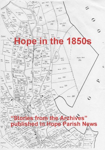
We are fortunate in Hope to have a copy of the 1847 Tythe Map hand-drawn by Edwin Chapman from the original in Derbyshire Record Office.
Every field is numbered and named and the allotment accompanying the map also gives details of owners and tenants, acreage and use, so we know whether the land was pasture meadow or arable. Names of fields include Hays, Carrs and Pingles, all associated with land but there are others that hint at past histories. Bear Baiting is part of a field on the corner of Aston Lane. Three Days Work is self-explanatory. Several fields include Butts in their name perhaps from the days when Hope archers were renowned. The intriguing Pouchmouth has now disappeared under the quarry. We still have much to learn from this special map.
If you take the path from Castleton Road to Eccles Close you climb the steps and enter the Croft belonging to John Tym. The line of trees mark the boundary with Joseph Wilcockson’s Croft and as you go through the gate you are entering Shirley Yard now known as Shirley Close. These narrow fields are the remains of medieval strip farming. We are walking through history.
Sources Hope 1847 Tythe map – detail
13. Changes in Edale Road
Beyond the Tythe Barn our knowledge of Edale Road in the 1850s becomes rather confused. A photograph taken in about 1900 shows that there used to be a small house in the corner of the Tythe Barn garden, then a gap, which was the entrance to the back of the Durham Ox. Next comes a house the lower part of which is today Watson’s Farm shop and then the property which was the Watson’s former shop.

There is a story that the small house was the home in the 1920s of Mrs Bowden’s gardener. His wife complained that the habituees of the Durham Ox woke her baby as they left the pub in the evenings. Mrs Bowden re-housed her gardener and had the house demolished.
We can only make a rough guess as to the occupants of that house and its neighbour in the 1850s. Likely contenders are Edwin Hobson and his wife Charity with two small children. He was an agricultural labourer and she was a dressmaker and milliner. In the larger house may have been William Rowland, born in Youlgreave, and his son Jacob, both of whom are described as “tinmen” together with four children aged between fourteen and seven, none of whom seem to have been at school.
Nearby lived Peter Rowland, also a tinman born in Youlgreave. His wife, Mary, was a mangler and they had three small children, two of whom were at school. Tinmen were tinsmiths and would have made pots and pans and other similar items.
We do know something of the next house (Watsons’ former Farm Shop) which has what the late Frank Money described as “a cat-slide roof”. This is an unusual building, unlike any other in the village and one of considerable antiquity. Some of the interior walls are very thick and the wooden roof trusses may well have had an earlier life elsewhere.
In 1850 it was owned by John Tym but was tenanted by Joseph Dakin and his wife, Hannah. They were described in the census as shopkeepers and Joseph was also a farmer of 12 acres.
14. Edale Road – The Fold
The Fold is an intriguing little cul-de-sac. It consists of two buildings. One fronts on to Edale Road and contains two houses. In 1850 the second provided four dwellings but there are now only three. They and the yard on the right belonged to the Hassop estate (the Earl of Newburgh). Originally there had been a further row of “weavers’ cottages” on the right hand side. These show up on the 1819 Enclosures award map but have gone by the 1847 Tythe map. Amazing to realise that the houses in the Fold are over two hundred years old. The Historical Society’s housing advisor, Andrew Bower, has seen old re-used timbers inside one of the houses.

It has been more or less impossible to work out who lived in the Fold at this time. William Howe rented the barn yard, but we have no Hassop estate record of the period to tell us who rented the houses. However the more recent history of these houses tells an interesting story.
In October 1911 The Fold was put up for sale. Lot 20 of the Hassop Estate Sale consisted of six cottages “built of stone with slab roofs”. (See the Estate Sale brochure map). There is a detailed description of each house. The two on Edale road each had one bedroom with a living room, scullery and pantry downstairs. The first two houses of the second block had been combined to provide two bedrooms, two living rooms, a larder and a small garden. The third had two bedrooms, a living room, scullery, larder and a small garden. The last house in the row had two bedrooms, two downstairs rooms, a scullery and a cellar. There was also a small garden and a croft at the side of the house. The tenants at this time are named as Mrs Greaves, Mrs Shirt, Mrs Watson, Mr Townsend and Mr Harrison – all local names.
The cottages were bought by John Robert Watson. They were in a poor condition and he had new fronts put on to the larger row of houses and possibly the elaborate cement lintel on the centre house. He was said to have complained that the repairs nearly bankrupted him as he had to pay the stonemasons fourpence an hour.
In 2012, as part of the Hope/Castleton project, the Society were given permission to dig a metre square test pit in the back garden of one of the houses. We came upon a very nicely built stone structure which was eventually identified as a mortar pit. Whether this dated back to the original construction of the cottages or was part of John Robert Watson’s refurbishment it was difficult to say.
Sources Andrew Bower, Robert Watson
15. Edale Road – Chapel Walk
In 1824 the houses in Chapel Walk and the surrounding land belonged to Jacob Darwent of Thornhill. Local Methodists had been meeting in one another’s homes until this time but in 1824 they bought the piece of land behind the cottages and set out to build a chapel. The signatories to the agreement were John Middleton, John Hobson, William Burgon and John and George Longden, all of Hope. The agreement says:-

“Wherein the said Jacob Darwent agrees to sell to the above mentioned persons 100 yards of land or thereabouts in the centre top of his gardens including a load in the front with the materials of a weaving shed, two pig holes and a necessary for the sum of £15.”
It was a very simple building, using material from the demolished pigsties and weaving shed and stone from the Parish quarry up beyond Crookstone. The builder was William (Arthur) Chapman of Great Hucklow, a noted Methodist local preacher with experience of building the simple chapel required. He was helped by local people who are recorded as carting stone from the quarry and sawing roof timbers for the “barn-like” structure. There was a yard in front with hitching posts for horses. It took ten years to complete but in 1835 Hope Methodists were able to take final possession of the land from Jacob Darwent and to start worshipping in their own chapel.
The houses in Chapel Walk are about 200 years old. In 1851 the occupants of Chapel Cottage were Thomas Howe, a butcher, and his two sons, Jonathan and Abraham, described as assistant butchers. At home was Thomas’s 15 year old daughter, Charlotte, who no doubt kept house for them. Living in one of the other cottages was John Robinson, a cordwainer or shoemaker with his wife, Elizabeth and two sons, John, aged 27 and Thomas, aged 20, also shoemakers. Their 4 year old granddaughter, Mary Platt, lived with them.
In 1847 John Holme also lived in Chapel Walk but he and his family were not there by the time of the Census. They seem to have moved in with John’s father, Micah, at Smithy Cottage to help him in the blacksmith business.
16. Bolsover and Kenmuir Cottages (40 & 41 on the Tythe map of 1847)
These two buildings, beyond the old Butcher’s shop, are set sideways to the road and would originally have had a long piece of land or croft beyond them.
Bolsover Cottage was occupied by two families. There are deeds that go back to at least 1785 when Thomas Wilcockson bought it from Francis Ingleton, a spur maker, and Benjamin Longden of Hope Woodlands. By the 1850s Mary Wilcockson, Thomas’s granddaughter, was living there. She was aged 73 and described as an Annuitant but at one time she ran a school there, as remembered by John Hadfield, one of her former pupils. His testimony was found amongst the house deeds.

In the other half of the cottage were Mary Wilson and her son Robert. She is described as a farmer of 6 acres and her son as an agricultural labourer. At the time of the census her grandson, Hugh Greaves, aged 5, was living there too.
Kenmuir is probably the same age as Bolsover. It was divided into three houses and was owned by John Robinson who lived there with his wife, Elizabeth, and two sons. All three men were shoe makers. If this sounds familiar it is because I have had trouble with the number of Robinsons who are shoe makers and in my last article attributed them to Chapel Walk. My apologies. There are at least two Robinson families who are shoemakers and it is not clear from the census where they live. I have been able to use the Tythe map information to fix this Robinson family at Kenmuir as John Robinson actually owned the house.
One of the other houses in the row was occupied by Joseph Siddall, a glazier. He is the only glazier mentioned in the census return. We are beginning to build a picture of the different trades and occupations that occur in the village.
Sources: 1847 Tythe and 1851 Census returns. Additional information from the Watson family.
17 Ebenezer House and beyond.

The next house on Edale Road (42 on the Tythe map) is a three-part building which has had various names. It has been “The Old Bell Inn “, “Ebenezer House” and older residents may remember it as a shop run by the Gillott family. In 1851 it was owned and lived in by Joseph Andrew who describes himself as a cheese factor and shopkeeper.
The property had barns at the far end, with the house in the middle and the two cottages by the road may once have been stables. Whether Joseph made his own cheeses or bought them from local people and sold them on we don’t know but he is not the only person to so describe himself.
Next door at what is now Ivy Cottage lived John Shallcross, an agricultural labourer, and William Marshall, a butter dealer. Their home was owned by Dinah Gould who also owned the next cottage and land surrounding it. This was Croft Cottage and Edwin Bradwell carried on his tailor’s business from there. He was a widower with four sons. The youngest two were at school, the elder two were described as “at home”. He employed two apprentices, Robert Bramall and Thomas Wragg, who lodged with Charity Hill and her grandson elsewhere on Edale Road.
Beyond Croft Cottage there were fields as far as Killhill, but in 1851 a building was erected to house the village hearse. The money for this was raised by public subscription and there is a plaque on the wall at the corner of Edale Road and Eccles Close to record this fact. A note amongst papers loaned to us by Jane Bramwell tells us that in 1837, when the list was compiled, the cost of the Hearse House and the hearse would be £60.0.0. Also listed are amounts collected from some of the local villages. Grindlow collected £5.3s, Offerton, £4.5s and Little Hucklow and Windmill, £1.9s. Abney and Abney Grange gave £3.1s, Brough and Shatton £3.2s.6d and Bradwell £9.0.0. These communities all used Hope church for burials. They would certainly be glad of a wheeled vehicle to carry the coffin such distances.
Sources:/ 1847 Tythe map, 1851 Census, Hope Historical Archives.
18. Edale Rd – Around Hope Mill
Opposite the end of what is now Eccles Close there was a footpath running towards the river Noe. Hawthorn House had not been built then and the footpath gave access to a house which was the home of Hannah and Mary Bennett, the sisters who ran a private school in the cottage next to the Old Hall. It continued past a barn and down to the river where a set of steppingstones gave pedestrian access to Hope Mill.
Behind the Bennett sister’s house were two cottages, later converted by Mr Freckingham into Higher Hall. At this time they were owned by William Wills Gould. Ann Gould, a farmer of 22 acres lived in one with her daughters and granddaughter. The other was the home of Godfrey Hallam, an agricultural labourer.
We know from documentary evidence that Hope has had a mill for several centuries. It was part of the estate attached to Nether Hall and was sold in 1602 to Adam Slack of Tideswell. A mill for grinding local farmer’s corn would have been an essential part of any village. The water for working the mill was stored behind a dam on the river Noe roughly opposite Upper Weir Cottage and the mill leat ran along a channel above the river bank to a shuttle which adjusted the flow of water to the mill. The water then went underground through a brick arched tunnel to appear in the goyt at the other side of the road beyond Kilnhill Bridge. The remains of the arch can still be seen. Changes by the Derwent Valley Water Board to the flow on the river Noe meant that by 1961 Hope Mill was unable to operate. It was sold by its then owner, William Eyre, in 1968.
In 1851 the mill was owned by John and Jonathan Longden and the miller was George Woodhouse. He lived in one of the two houses below Kilnhill Bridge with his wife and grandson and a young fifteen-year-old miller’s apprentice, Samuel Bolsover. Next door was John Cottrill and his wife Hannah and their five children. He was an agricultural labourer and his eldest daughter and son were at school, but the next two daughters were “at Home”. Maybe a farm worker’s wages would not run to schooling for all the family.
Over the bridge and on the opposite side of what is now Bowden Lane was a smallholding owned and run by Charles Hobson. He farmed 12 acres and also described himself as a tea hawker, perhaps another way of supplementing his income.
Sources: Castleton/Hope Research 2012 – “Medieval Lives in Castleton and Hope”. “Goin’ Down T’ Th’ Mill” by William Eyre. 1847 Tythe Map. 1851 Census Returns
19. Killhill Farm and beyond

Our journey continues along Edale Road, taking in a series of farms, each of which is built sideways on to the road at the head of a parcel of land.
The first of these is Kilnhill (or Killhill) farm, one of the older buildings in the village. The name is intriguing. Was there a kiln in the area at one time? A former owner, the late Hubert Eyre, was proud of the fact that the property had belonged for many generations to his relations, the Wilcockson family from Hope Woodlands. In the 1850s the farm belonged to Joseph Wilcockson and consisted of forty five acres divided into five fields. The tenant farmer was Levi Hadfield who lived there with his 60 year old mother, Mary and his 14 year old nephew, Henry who was an errand boy.
Beyond Kilnhill it becomes very difficult to work out occupancy. The land around Weir Cottage appears to have been owned by Micah Hall, but there is nothing to show that he lived there. Upper Weir Cottage and Mill Farm give a similar confusing picture. Some of the land was owned by Robert Howe Ashton of Losehill Hall.
It is not until we come to “Greenwood” that we can more certainly identify the occupants. They were the Waterhouses. Jabez Waterhouse describes himself as an agricultural labourer, but according to the tithe allotment he owned the property and land surrounding it. He lived there with his wife Emma and two small daughters, and the census return shows that the family had a house servant, 14 year old Mary Grafton, who is described as a daughter in law, which seems strange. Also living here were two lodgers. James Greaves was a retired mercantile clerk aged 60. Walker Hardy was 26 at the time of the census and describes himself as a tea dealer and draper.
What is now Chapman Farm was owned by James Brown. The building was divided into two dwellings. In one of these lived Sarah Brown, a dressmaker. The other was the home of widowed Hannah Watson who describes herself as a farmer of 3 acres. Her eldest son, John, was a butcher and there were four other children. Two of the boys were at school. The eldest daughter and the youngest son were “at home”.
Sources: Tythe Allotment 1847, Census Return 1851 Photo by David Price for HHS.
20. Around the Cheshire Cheese
The occupant of Rose Cottage, George Pearson, was a factory bookkeeper, which was unusual amongst the farmers, agricultural workers and tradespeople of the rest of the village. He rented the cottage from Richard Burgon and lived there with his wife Martha, daughter Charlotte and son Benjamin. There was also a lodger, 23 year old Mary Ann Hadfield who had private means.
Next door is the Cheshire Cheese Inn which has been a pub for many years and was said to cater for the pack horse trains carrying salt from Cheshire. The landlord was Robert Cotterill, a widower with three daughters, Sarah, Ann and Elizabeth, all at school. To help him run the pub, shop and farm, his daughter–in-law, Mary Burdekin, acted as housekeeper and waiter with Maria Marshall helping her in the house. Joseph Pollard worked on the farm.
The old photograph shows the pub in 1877 after it has had a new frontage. The cutoff suggests that the remainder of the building formed a second dwelling.

It is thought that what is known as “Toll Cottage” across the road and the adjoining barn were also part of the Cheshire Cheese. The Toll house served as a dining room to the pub at one time and the barns would have been stabling for the pack horses.
The present owners of Greaves cottage have done a lot of research into the history of their house. Until as recently as 1965 their home was two cottages, possibly 17th century in date. The smaller cottage was one up and one down and may originally have been a barn. The larger had four rooms and a larder and two fireplaces, one with a range. An interesting feature of the larder was a stone trough in which brooms were “pickled”. The story is that these were later sold at Barnsley market. In the 1850s George Hall owned the building and the surrounding fields and we think that one of the cottages was occupied by George Ashton, a young agricultural labourer, with his wife, Catherine, and baby daughter, Harriet.
Sources: “A History of Greaves Cottage”By John & Aileen Booth. 1847 Tythe Allotment & 1851 Census returns.
21. Continuing up Edale Road
Next to Greaves Cottage is a building with an old date stone from the 1600s. We have been unable to work out whose home this was in the 1850s, or even whether it was a dwelling at all. It may have been one of two barns adjoining Greaves cottage. It would be interesting to know whether anyone has any further information.
However we do know that the next house, Bower Cottage, was owned by Micah Burdekin at this time and that it was lived in by James Burdekin, an agricultural labourer and his wife Mary. Their 17 year old son, Josiah, was also an agricultural labourer. Their three daughters, Martha, 11, Louise, 7 and Elizabeth, 5 are described as “at home”. Maybe the wages of a farm labourer did not rise to school fees, particularly for daughters.
Beyond Bower Cottage is Bleak House, which faces the road, unlike other properties along Edale Road. It is thought to have been built in the early 1800s by Betty Ward whose family owned the land around what is now called Mead Far. It takes advantage of the natural slope of the land to give views across the valley.
In 1837 Sarah Ward at Mead Farm was appointed guardian to George Samuel Ward from Bleak House when his father, George Ward, died.

By 1851 George Samuel was farming 11 acres on his own account at Bleak House. He was helped by his brother Charles Ward, who also lived there with his wife, Caroline and their two small children
At age 68 Sarah was still running the 15 acre Mead Farm though it was not called that until much later. She was helped by her son, Henry, and employed a live-in servant, Hannah Woodroffe, aged 16.
Sources: 1847 Tythe Allotment, 1851 Census Return. Booklets “Bleak House” and “Mead Farm” by Margaret Hawson for Hope Historical Society Archive. Photo of Bleak House from Jayne Fox. (HHS Photo Archive)
22. Edale Road – Town Head
At the end of Edale Road is a cluster of cottages known as Townhead. Croft Head, the first of these, was probably built in the late 17th or early 18th century. It was a farm of 48 acres owned by the Earl of Newburgh (of Hassop Hall). The tythe map allotment shows George Bocking as tenant. He was at this time landlord of the Old Hall Hotel and seems to have lived there with his family rather than at Croft Head. He describes himself as an innkeeper and coach proprietor so perhaps Croft Head is where he kept the horses and coach for the transport business. There were two farm servants as part of the hotel establishment who may well have worked here.
I am indebted to Di Curtis for the following information on the property now known as Townhead Cottage. It was originally called Townhead Farm and was also owned by the Earl of Newburgh. It is one of the older houses in the village, probably dating to the early 17th century (Andrew Bower). The building consisted of a house and attached barn and fits the description of a Derbyshire Croft and Toft.

The house roof was supported by two cruck trusses, one of which has been truncated during the many alterations which have since taken place. The land holding consisted of approximately 4.5acres and is still intact today.
The Ashton family lived there around this time. We cannot say with certainty, but it was either George Ashton, an agricultural labourer and his family, or Nathan Ashton, a gardener. George Ashton is described as a water bailiff in the 1861 census and his memorial in Hope churchyard records that he was “Head keeper of Peak Forest Angling Club for 40 years.”
The Hall family who also live at Townhead have been associated with Hope in written records since at least 1585, when Thomas Hall’s name appears in the muster book taken at the time of the Spanish Armada. Thomas and Robert Hall were local volunteers during the Napoleonic wars. In more peaceful times the family are recorded regularly in the Parish Records during the 17th and 18th century as churchwardens and charity trustees. In the 1851 census their home was occupied by Thomas Hall, who farmed 55 acres with help from his elder brother, Micah and nephew, George. His sister Hannah kept house for them helped by niece Harriet and Mary Frith.
Sources: Di Curtis – “Townhead Cottage”. 1847 Tythe allotment, 1851 Census return.
23. Hope Townhead
Hope Townhead had several notable families living there. We have already met the Hall family, but living nearby at Bridge Cottage was Jonathan Longden and his family. Jonathan was a stalwart of the Methodist church in Hope and one of the original signatories to the purchase of the land to build Hope chapel. He was 58 at the time of the census, a farmer of 34 acres. Mary his wife was 54 and his daughter Sarah was 18. Robert the eldest son was 16 and 12 year old George was still at school.
Another Longden family at Townhead was John Longden aged 64, farming 30 acres of land. He had a full household, with Mary, his wife, his two grown daughters Mary and Maria aged 23 and 21 respectively and his son, 17 year old John, together with two small grandsons Walter Allott (5) and baby Wilmot Burgon. It is intriguing to speculate on how such an assortment of surnames could occur.
Woodroffe is a very old name in the annals of Hope. Besides being church wardens for several generations, a Woodroffe was overseer of the poor in the early 1800s and also Surveyor of the Highways responsible for seeing that the Hope inhabitants repaired the roads throughout the parish.
There were two branches of the family in Hope at this time. We already know of Nathan Woodroofe, who kept the Woodroofe Arms. Living at Townhead was another Nathan Woodroofe, a married man aged 40, who farmed 74 acres and had 3 labourers to help him. He had seven children – John aged 18, 4 daughters, Jane, Mary, Ann and Maria ranging in ages from 14 to 6 and all at school and two small sons Benjamin (4) and George, newly born. Nathan’s wife is not included in the census, but the household also contained Fanny Ashton, a cousin as housekeeper and an elderly aunt, Martha Bagshaw, as assistant housekeeper.
It has been difficult to pinpoint where families lived in the Townhead area. However we are grateful to Vivienne Taylor who has researched the area around Underleigh and Losehill House Hotel. A house owned by James Burdekin appears on the 1847 Tythe map. In the census he is described as an agricultural labourer living with his wife Mary, 17 year old son, Josiah, also a labourer and three daughters “at home”, Martha, (11) Louisa (7) and Elizabeth (5).
Sources/: Vivienne Taylor –“Underleigh”, “Loose Hill House Hotel”, 1851 Census Returns, 1847 Tythe Allotment
24. More on Townhead
Following last month’s piece about Townhead I received an e-mail from Moira Monteith, who lived at Bridge Cottage for over 40 years. Her memories of the house and other farms are so interesting that I have her permission to quote them here.
“I was, of course, particularly interested in Townhead. It always did seem like a small community on its own, not quite Hope. Did Vivienne Taylorhave any ideas about the Green? Basically the field behind our house I think. I always wondered if it had been common grazing or something like that. I would imagine the old Ibbotsons’ farm, where Leslie Edmonds lives now, must have been quite old. It was in the pattern of the old farmhouses in Scotland and Ireland and possibly England, a long line of single rooms, leading one from the other. Mr Ibbotson had built a large stone fireplace in each room so they all looked rather top-heavy. The kitchen was the first room. Mrs Ibbotson had bad arthritis and asked for a Feverfew plant from our garden and apparently ate leaves from it each day. She described her grandmother who had lived in Hathersage as ‘a stone age woman in a stone age kitchen.Very graphic.
There was a building above the farm, up Losehill, which Mr Ibbotson said had been lived in during former times. It was more of a dilapidated barn as I remember but I suppose people might have lived in it previously.
The interesting items about Bridge Cottage were the railway connection and the bankruptcy. It was built by one of the Longdens, perhaps Jonathan, who came from somewhere near Derwent. I don’t know where he got his money from to buy the land. He built it of limestone which is different from all the other houses round about and I think left it to his daughter. It was handed down from one family member to another without any will, so when it finally was sold, in 1959 I think, they had to write an account of the owners and get this signed by some official in Sheffield. At some point however, they must have let it, presumably to make money, to a Mr Moon. A Moon descendant came to the house once and said her sister had been born there.
Joan Clough looked up the census (1891) and said the house had numerous occupants, far more than could have slept in the rooms, so they must have had sheds, and presumably were working on the railway. They weren’t Irish, Joan said, but came from different parts of the UK.
At one stage the owner (of Bridge Cottage) went bankrupt and the Squire person who lived in the Old Hall, Balguy, did his best by whichever Longden it was and organised a public hearing in the Cheese (think of the excitement!) and I think he escaped the term ‘bankrupt.’ Maybe that was when they let the house.”
Personal Comunication, Moira Monteith
25. Farms around the Parish
Recently some members of the Historical Society have been working in the churchyard, clearing overgrown corners and removing encroaching ivy and vegetation as part of their latest research project. Tackling an area under shrubs next to the churchyard wall we came across three gravestones propped up and hidden.
Clearing away some of the moss that covered one of them a familiar name was revealed. Recently I wrote about Jonathan Longden at Bridge Cottage. Here was his gravestone. It was like meeting a friend – a happy coincidence that makes researching Hope’s history such a rewarding and interesting occupation. The two other gravestones were for members of the Middleton family, a well known name in Hope. All the gravestones were in a fragile condition and will need care in cleaning them before we can decipher their full inscriptions.
Continuing with our house-to-house survey. In 1851 the census enumerator started in Hope parish by recording the farms that lie in the hills surrounding the village beginning with Nicholas Woodroffe at Townhead, whose family we have already met. There are over eighteen farms of varying sizes scattered along spring lines on the slopes of Loose Hill and Win Hill, with more on Eccles. Together with the residents of the village who proudly declare themselves as farmers on the census form, however small their acreage, agriculture is the primary occupation locally.
The tythe map has set us a few puzzles when it comes to identifying some of the farms. This is not helped by the fact that the census enumerator did not keep to any particular order when visiting properties, and did not always identify a house by name.
The next place that we can identify with certainty is Oaker, or Oakwood as it appears on the census. It was a farm of 56 acres, most of the land being owned by the Middleton family whose farmhouse was in the centre of the village, and is now the Spar shop. Oaker was run by John Wilson for his 90 year old father, Joseph, with help from 24 year old grandson, Thomas Barker. The house would have been pretty full, because besides Dolly, Joseph’s 85 year old wife, there was Susannah, John’s wife and an assortment of young grandchildren, Joseph and Fanny (scholars) and Charles and one year old twins George and Georgianna.
Sources – 1847 Tythe Allotment and map, 1851 Census
26. Crookstone to Edale End
The area at the northern edge of the parish shown on the accompanying copy of the tythe map was owned by Millicent Greaves and farmed by Fanny Riddall. It covers an area from just south of Crookstone barn and climbs up onto the Kinder plateau, curving round to include Madwoman’s Stones and meeting other parish boundaries at the trig point. Those of you who have walked up there will know what wild country it is. Neither Millicent Greaves nor Fanny Riddall appear in Hope’s census list, and Crookstone is clearly a barn and not a dwelling

To the south lies the area known as the Brinks. The land along the top of the ridge, bordering Hope Woodland, belonged to the Hassop estate via the Earl of Newburgh whilst below that the land running down to the river Noe and beyond belonged to the Bagshawe family.
These ownerships may have roots in the time when Hope was part of the King’s Royal Forest, where deer were hunted and strict forest laws were in place. By1626 King Charles I was looking for revenue from the deforestation of the area. The tenants and commoners wished to purchase the tenancies and in 1640 the Duchy of Lancaster was authorised to negotiate a division of the wastes and commons within the Royal Forest. However the Civil War and Interregnum intervened and nothing further was done. Land holdings were an important asset and disputes arose between Thomas Eyre of Rowtor and Thomas Eyre of Hassop and later his son, Rowland, who acquired land in Hope and other parts of the Forest and enclosed it for their own use. The residents of Hope and other local villages realised they would have to ratify the title to their share of the land if they were not to lose out and in 1709 asked Adam Bagshaw of Wormhill to bring their petition before the Duchy Court. The court made the required decree but its ratification varied from village to village. Hope’s was not until a century later.
In the 1850s Edale End, on Hope parish’s boundary with Edale, was then a large farm of 145 acres. It was owned by Rachael Bagshaw, but tenanted by the Cottrill family. Betty (64) was head of the family but her son William ran the farm with help from two living-in farm servants, Thomas Eyre and Benjamin Dawson. William was married to Emma and they had two small daughters. Grandaughter Ann completed the household as a house servant.
Sources;1847 Tythe map. 1851 Census
The history of the Peak Forest written by Di Curtis. This can be found on our website http://www.hopehistoricalsociety.co.uk/publications/HLF Reports/Peak Forest
27 Harrop Farm to Birchfield
The next farm along the spring line above the River Noe is Harrop Farm, (170 acres). This was owned by Rachel Bagshaw but the tenant was Joseph Kirk who was also tenant for the land around Norman’s Farm across the river. This would have been a large combined acreage but whilst his mother Sarah was the nominal head of the household, Joseph’s brother, William and sisters, Ruth, Ann and Sarah were involved on the farm, and there was also a farm servant, William Waterhouse.
Rachel Bagshaw lived at Fulwood Holmes. She was 80 at this time and the 53 acre farm was run by two farm labourers, Ambrose Dronfield, and a fifteen year old, Isaac Cheetham, whilst daughter, Mary Wright, and a house servant, Betty Dronfield, possibly Ambrose’s wife, completed the household.
Fulwood Style (48 acres) was owned by 76 year old Thomas Barker. He was helped by his son-in-law, John Hallam. John’s wife, Elizabeth and 12 year old twin grandchildren, William and Mary Burdekin, also lived there. The difference in surname for the grandchildren suggests other family connections, which is intriguing.
Fulwood Farm is listed on the census return. This was a small 16 acre farm on the hillside above Fulwood Style on the edge of what is now “The Homestead”. The building has long since disappeared but in 1851 it was the home of John Kirk and his wife Hannah and their eight children ranging in age from ten year old Hannah to a new baby not yet named. Five of the children were at school which must have been quite a strain on the resources of such a small farm.
Birchfield Farm was another small farm with an elderly farmer. Richard Burgon was 86 and was a tenant of the 24 acre farm owned by Thomas Broomhead. The household also consisted of his wife and daughter. It is not obvious where the labour for the farm came from, but there were several people listed in the census as “farm labourers” who may have been employed there.
We have recently been given an account book from Harrop Farm from 1950 to 1970 by Mrs Pamela Hazelhurst, whose parents William and Doris Steven farmed there at that time. Also in our archives is a diary of farming at Eccles Farm for 1890-1written by George Bennett and an account book from Pindale Farm from 1871 to 1896 given us by Jane Bramwell. The research group are looking forward to comparing these various farming accounts to give us a clearer picture of farming in Hope in the last two hundred years.
Sources: 1847 Tythe Allotment; 1851 Census Return.
28. Farfield to Lane Side.
Thomas Broomhead was an absentee landlord who owned both Farfield Farm and Crabtree Meadow. His tenant was 57 year old Joseph Eyre who lived at Farfield with his wife Charlotte, Joseph Wright, a farm labourer and an eleven year old house servant, Mary Shallcross. There was also a lodger, Martha Craven.
Joseph farmed 32 acres, part of which would include the land at Crabtree Meadow. There was no grand house at Crabtree then, just a small farmhouse and accompanying barns. The house was lived in by Thomas Hall aged 85 who is described as an ex-farmer and pauper. There were also his daughter, Elizabeth, a charwoman and his grandson, John, an agricultural labourer who no doubt helped Joseph Eyre on the farms.
Thomas Hall must have grown too old or infirm to work on the farm and would have applied to the parish for poor relief. This was a pot of money raised by a levy on the inhabitants of the village and was administered by the Overseer for the Poor. At this time the overseer was Nicholas Woodroffe from Townhead. Thomas may have appeared on the census as a pauper, but he proudly proclaims that he had been a farmer. The Poor Law will be an interesting further study.
North of Crabtree Meadow, on the edge of Hope parish lies Kings Haigh, at this time a farm of 22 acres owned by the Hassop estate. There has been a property on this site since at least the 13thC when it was held for the King by members of the Eyre family as sheriffs of the Kings hunting forest. See below to access more information about the history of this land.*
At this time it belonged to the descendant of that early Eyre, the Earl of Newburgh. The tenant was John Marsden, a bachelor, farming the land and also running a wheelwright’s business. He was assisted in this by his nephews John and Henry Ashton. His sister, Sarah Ashton, and niece Emma completed the household.
On now to Laneside, a farm of 55 acres, large by Hope standards. According to the Tythe allotment it was owned by William How and the tenant was Thomas Elliot. He was helped by his brother, Joseph and his son, Thomas. Also living there were Mary, Thomas’s wife, Robert Hallam, his eight year old grandson and Harriet Oddy, aged 15, a servant who came originally from Hathersage.
As we visit each household it is interesting to imagine what the lives of these people would have been like one hundred and seventy years ago. The farms would have been dependant on horses for their main power in the fields. Water would come from wells and lighting would be by oil lamps or candles. More about life in Hope anon.
Sources: 1847 Tythe Allotment. 1851 Census Returns.
29. Brough to Loosehill
Brough looks a very compact village – easy for the Census enumerator you would have thought. In fact it would have been complicated because four separate parishes join in the village, Aston, Hope, Shatton and Bradwell, with the boundaries being defined by Peakshole Water and Bradwell Brook. Only two properties are listed in Hope – that of Thomas Middleton at Hope House in the centre of the village and Charlie Pearson on Eccles Lane. Thomas owned one large field, the Halsteads, adjacent to the house and described himself as a farmer of 12 acres. He lived in Hope House with his wife Nancy and two small daughters, Mary Anne and Elizabeth. Charlie Pearson did not rely solely on farming but was also a Cotton doubler, perhaps working in the Bradwell mill. He was 62 and shared the farming with his brother Benjamin who owned fields adjacent to Eccles Lane. He had a house servant, 25 year old Mary Richardson.
The name Eccles derives from Ecclesia or “of the church” and the fields around this part of the village have appeared on land deeds under this name way back to the 12thC. Hope church was an important missionary centre and the extent of the Hope ecclesiastical parish dates from this time. On the lane side near Eccles Farm there used to be an old preaching cross which now sits near the north door in Hope churchyard.
Eccles Farm and its land was owned by William Fleming and worked by two brothers, Alexander and William Greaves. Alexander was unmarried and farmed 63 acres, with the help of two labourers whilst his older brother, a widower, worked 136 acres with help from one labourer. Benjamin Hallam aged 44 was a farmer’s assistant, and Martin Kennedy, (25) and John Hallam (17) were farm servants. Ruth Dakin was the housekeeper. Alexander wrote a diary about the farm which we hold in our archives.
In 1847 the next farm, Pindale, was rented from the Earl of Newburgh by Adam Howe but by 1851 a new family had moved in. There was no quarry then and Joseph Eyre would have farmed all the 108 acres of land around the intriguingly named Pouchmouth, with help from Elijah Hallam. He and his wife Hannah had five children ranging in age from eight to two. The eldest, Thomas would write his own accounts for the farm twenty years later giving us an interesting glimpse of how life on a small farm was organised.
We have nearly completed our circle of farms around the village. Fields farm was again owned by the Hassop estate and Godfrey Hall and his wife Mary farmed there with help from George Rowsley (14).
Spring House, a farm of 22 acres, was owned and farmed by William Wills Gould with his wife Abigail and schoolboy son Walter living there too.
Lose Hill farm, the last on the census, was owned by Thomas Barker and its 65 acres were farmed by George Barker. His wife Rachel and three children, John (10) at school, Henry (7) at home and baby Mary completed the household.
Sources: HHS Archives, 1847 Tythe Allotment,1851 Census Return.
30. Farming in Hope
In the census of 1851 there were 91 households in Hope. Of those 45 people called themselves farmers or ex-farmers. 21 farmer’s sons and daughters are listed individually, and there were 12 farm servants living-in on the farms. Also listed are 20 agricultural labourers living separately. So there were almost a hundred people directly employed in agriculture. There were also people who made their living from activities associated with farming such as blacksmiths, wheelwrights and saddlers.
Acreage of land farmed varied from the 3 acres farmed by Hannah Watson somewhere on Edale Road to the Greaves brother’s joint venture at Eccles farm of 199 acres.
The Tythe map of 1847 gives us a picture of land ownership in Hope. Every field is named and numbered and there are 741 of them. I was interested to find that most farmers owned their own farmhouse and barn yard even though they might rent the rest of their land from what was usually an absentee landlord. There are 93 separate landowners listed on the Tythe apportionment and some are unexpected. Hope Church Wardens owned four fields, Hope Sick Club had two, as did Bradwell Chapel Trust and Eyam School Trust. The vicar had three fields, two called Middle Vicars Part and one Near Vicars Part but at some stage he had lost Far Vicars part to the Earl of Newburgh. The Hope Impounder had two fields and these still exist today as places where stray cattle would be impounded. Other field names describe the land or its history– Six Days Work, Bear Baiting, Noose Croft, Reedy Carr.
By far the largest landlord was the Earl of Newburgh of Hassop. Historically Thomas Eyre had acquired land in Hope to such an extent that local people had complained. However, a local farmer William Middleton, whose farmhouse and barns were in the centre of the village, had the next largest holding. He died in 1849 so by the time of the census his son Robert was living in the farmhouse (now Spar) and presumably farming the land. Interestingly John Talbot, as part of his research, found an item in the Derbyshire Mercury of February 1858 in which Robert has put land on the market. I have not had time to look at this in detail but every field has its tythe map name and reference and the sale covers land and also buildings in the centre of the village.
Sources1847 Tythe Map and Allotment, 1851 Census record, The Derbyshire Mercury 3.2.1858
31 More about farming.
Farming was never an easy occupation, particularly if the acreage was small, and many people who called themselves farmers had to find other ways to supplement their income. George Bocking, landlord of the Old Hall Hotel, ran an Omnibus service to Sheffield on Tuesdays, Thursdays and Saturdays. Robert Unwin ran a carrier service from his farm in the market place. Several farmers were corn dealers and others sold cheese or tea or butter in an attempt to make ends meet. Richard Hobson is listed as a sacking manufacturer in the trade directories.
Other trades associated with farming were those which serviced the farmer’s carts and animals. John Marsden at Kings Haigh was a wheelwright, with his two apprentice nephews, and there was also a wheelwright in Brough. The village could support two blacksmiths. Micah Holmes and his son John and their two apprentices shod horses at the Netherhall end of the village and Thomas Rowland and his sons did so at the other end. They also both produced iron work. John Proctor had a saddlers and harness shop in the Shambles. John Watson had his butchers shop there too whilst Thomas Howe’s butcher’s shop was on Edale Road. The mill for grinding the farmer’s corn was run by George Woodhouse with help from his apprentice, and of course there was another mill in Brough.
George Wombwell and his son were the resident veterinary surgeons, so farmer’s animals were cared for. Possibly better than the humans as there was no doctor in Hope at this time.
A market at which to sell their animals and produce would have been important. Hope first had a market in 1715 when John Balguy of Hope Hall set up the procedure for establishing one. According to the trade directories this had fluctuated in fortune and by 1850 was in abeyance. However John Talbot has a poster of 1853 in which farmers from Hope and seventeen surrounding villages are working to set up the market once again. There were forty seven people involved in representing their villages for this venture, twelve of them from Hope, so let us hope it was successful.
John Talbot has been loaned a set of papers relating to the Market by Alastair Sneddon of Bagshaw’s Auctioneers at Bakewell. Whether it ran continuously from 1855 we will perhaps find out. I certainly remember it as a going concern, thirty years ago, operating next to the Old Hall car park where the houses now are.
Sources 1851 Census Returns,Bagshaw’s Trade Directory, Kelly’s Trade Directory, John & Esme Talbot (poster)
32. Hope Village.
If you had lived in Hope in the 1850s your needs would have been well met. There were people to make your clothes for instance. Edwin Bradwell had enough business as a tailor to be able to employ two apprentices. The ladies were equally well catered for with Fanny Howe, Charity Hobson, Grace Pollard, Sarah Bolsover, Sarah Brown, Elizabeth Waterhouse and mother and daughter Dinah and Mary Gould all offering to make dresses and bonnets and put stays in the dresses for that extra fashionable touch.
Local shops provided items to supplement what you could not grow or rear on your own croft. Robert and Betty Unwin kept a grocers shop in the Market Place and Joseph Andrew at Ebenezer House was a cheese factor and grocer. The taste for tea was catered for by Charles Hobson and Hardy Walker also dealt in tea in his draper’s shop. John Cottrill and John Dakin and his wife also had shops in the village though we do not know what they sold specifically.
There were also plenty of people to supply you with footwear. Two branches of the Robinson family were cordwainers (boot makers) as was Robert Ashton. We have in our archives copies of the accounts kept by the Hobson family at the Durham Ox Inn who also made boots and shoes for men and women
Other household items were provided by two branches of the Rowland family who called themselves “tin men” and beat out pots and pans and other cooking utensils. When you broke your windows Joseph Siddall as a glazier could mend them for you. Nathan Ashton would keep your garden tidy and if you needed lodgings then Elizabeth Robinson would oblige.
Elizabeth Pollard and Elizabeth Marsh offered their services as charwomen and Mary Rowlands would mangle for you on wash days. Elizabeth Marsh was a pauper, trying to supplement her meagre income and support her three children. She was aged 28 whereas the only three other paupers in the village at this time, Thomas Hall, Adam Bolsover and Martha Harris, were all over 75.
Other people worked outside the village. John Robinson was a weaver and George Pearson was a factory bookkeeper, both possibly working in Brough.
The other important set of businesses in Hope were the pubs. In the days when there was no piped water for drinking people relied on ale to quench their thirst and Hope was well provided with places to do just that, either as an ale house, where you took your jug to be filled for the family meal or as a place where you could enjoy a sociable pint. The Rowland sisters ran the Horseshoe and the Hobsons looked after the Durham Ox. The Woodroofe Arms and the Cross Daggers Inn were the two main pubs in the village, but further up Edale Road the Cheshire Cheese would supply the needs of those in that area.
Sources: Census 1851.Doreen Sedgewick – Hobson Accounts.
33 Summing up (Part 1)
In the 1851 census we are told that there were 429 inhabitants in Hope, 215 male and 214 female. Of these 138 were children, but not all of them went to school. A proportion of them were “at home”, either because they were in their teens and could be said to have finished their education, or because they were under school age. The teenage girls “at home” may have helped to look after the younger children.
There were 66 “scholars” but we don’t know whether they went to the school run by Hannah and Mary Bennett at the Old Hall cottage or to the Free School on School Lane.
The school building on School Lane was built in 1655 and by this time was showing its age. Various items in the parish accounts show that moss was purchased to fill gaps in the walls and a new heather thatch was laid. By 1858 the building was replaced with a new school on the footprint of the old one. During the demolition the remains of a Celtic cross were discovered, used as a lintel and building material when Parliament decreed that such crosses should be destroyed back in 1654. This cross was eventually restored and placed in the churchyard. There would originally have been a schoolmaster’s house, shown on the tithe map, on the site of the current church car park. The cost of rebuilding the school and furnishing it with desks etc was £263.18.9d, the money raised by public donations.
There were two churches in Hope, the oldest being the Anglican St Peters with roots back to Anglo Saxon times and a building started in the 13thC. The ecclesiastical parish spread very widely from Fairfield, near Buxton, to Stoke, near Calver and from Hope Woodlands to Grindlow. Not even Bradwell had its own church at this time and people were buried in Hope churchyard from very far afield. The Historical Society is planning an exhibition in Wakes Week which will show this and many other aspects of our churchyard memorials.
Much more recent was the Methodist Chapel built by local people in 1835 on land given to them by Jacob Darwent and catering for the growing number of non-conformists. Bradwell had at least three Methodist chapels so when Hope’s chapel was built, the vicar’s wife, Mrs Cave Brown Cave, had been known to join the congregation perhaps concerned that her husband’s flock at St Peters was being adversely affected.
Sources 1851 Census returns:1847 Tythe map: Notes from a Peakland Parish: Derbyshire Mercury, Nov. 1860
34. Summing Up.(Part 2)
The 1851 census tells us that Hope had 99 houses and 429 residents. We know that there was no running water and lighting would be from candles and oil lamps. By contrast it is interesting to see what is happening in the rest of the country. The first subterranean cable had been laid under the English Channel, and the Royal Marsden Hospital had opened in London as the first for specialist Cancer. The Arsenic Act restricted the use of arsenic in food and the Window Tax was abolished.
One event which would have excited interest in Hope was the Great Exhibition held at the Crystal Palace in Hyde Park in 1851. The inspiration for this amazing building came from Joseph Paxton’s lily house on the Chatsworth estate and would surely have been talked about locally.
In an era when there was little state help if you fell on hard times Hope residents had already started a branch of the Oddfellows Lodges which, as well as the social side, saw that members received sick pay if they were unable to work. Later in the decade a Sick Club was instituted. We have already seen how a group of local farmers were working to restart Hope market.
A parish Bull was kept by Benjamin Watson, part of another local charity to help farmers and there is the equivalent today. There is still a Bull Meadow field in the village.
Whilst Hope was self-sufficient in the services and shops it had to offer there was no one listed in the 1851 census as working in the quarry, which had a very good reputation for the quality of its lime. Nor was anyone working in the lead mines even though they were so close at hand in Bradwell and Castleton.
Sources:/1847 Tythe map and Allotment./1851 Census,/ Hope Historical Society Archives.